Avoiding Hurricanes at Walking Speed, Part 1
Background
In 2021 and 2022 I was helping Erden Eruc with his attempt to be the first person to row, single handed from North America to Mainland Asia. Erden’s journey began in Crescent City, California, and his plan was to sail from Crescent City to Hong Kong, his trip is documented in the blog linked above,
Erden works with Ocean Recovery Alliance, their work is essential in providing evidence of the human impact in our oceans. Adventurers, ocean racers, and cruisers are essential in helping ocean debris researchers identify how humans are impacting the oceans from thousands of miles away.
Having routed sailboats primarily, one consideration in helping with Erden’s routing was speed, his, as a rower, was typically around 2.5-3kts.
When you consider that we walk at about the same pace, I had to really consider the significant amount of lead time needed on any heading change, and, given the unpredictable nature of most storms, had to make sure that each change kept open to him as many options as possible.
The 2021 Hurricane Season
During that time, the west coast coastal trough was stronger than typical, and it put Erden on a more southern route than initially expected. Also, on top of the stronger than usual coastal trough, 2021 was a pretty active hurricane season in the eastern Pacific.
Since Erden was further south than planned, we had to really keep an eye on each tropical wave. Because of the southerly push and some technical communication issues that needed to be addressed, Erden had planned to stop in Honolulu.
Eastern Pacific Hurricanes
Eastern Pacific hurricanes mostly have two genesis points, the Gulf of Tehauntepec and the Gulf of Papagayo.
As tropical waves move through southern Mexico into the Gulf of Tehuantepec or along the Honduran/Costa Rican border into the Gulf of Papagayo, they move over water generally around 29-31º C and gaps in the Sierra Madre de Chiapas create the additional windspeed acceleration and lifting of cold air to create conditions perfect for Hurricane genesis.
This is of course also dependent on the amount of moisture in the region west of there.
Hurricanes in the eastern Pacific will continue to intensify generally until they move outside of the 26ºC water temp range, or begin to entrain dry air from a nearby high, or experience vertical sheer as they move into opposing winds.
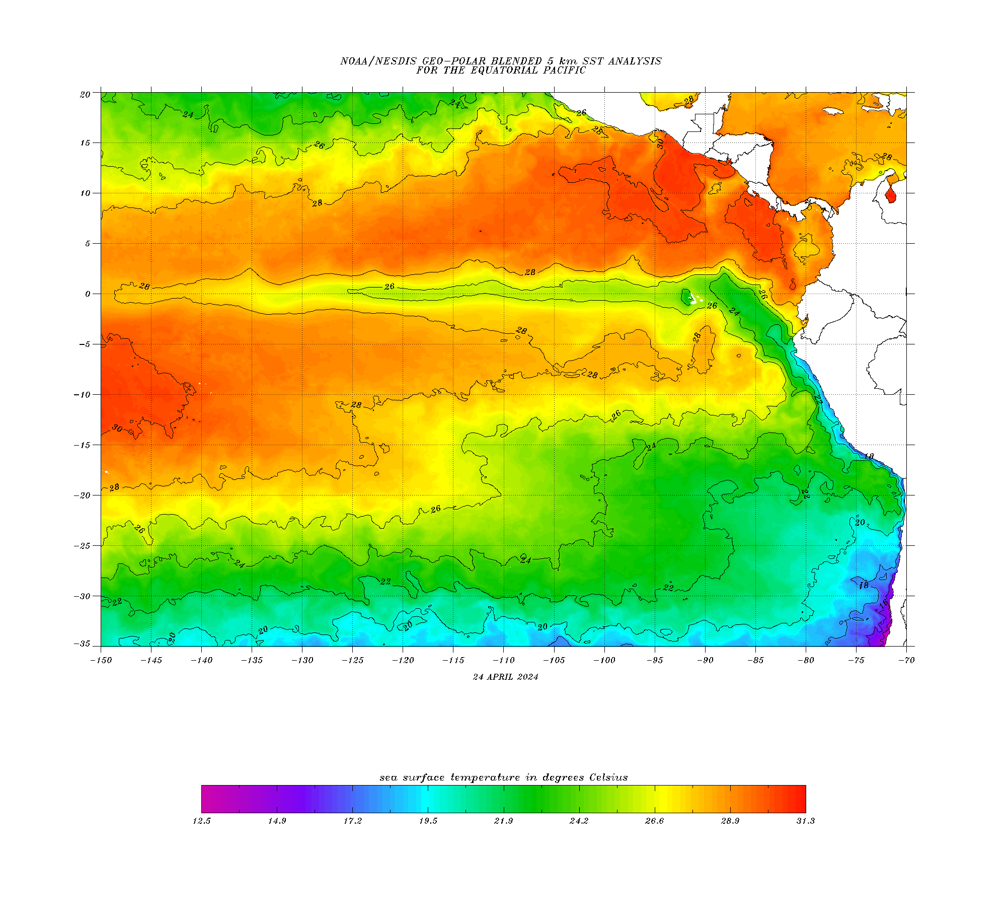
Sea Surface Contour chart showing the higher temps in Gulfs of Tehuantepec and Papagayo - 28-Aug 2022
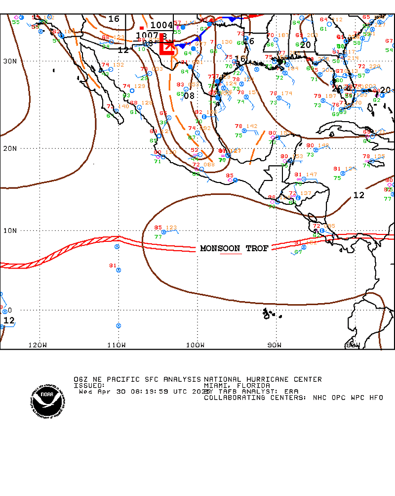
Tropical Waves passing over Central America - 28-Aug 2022
An Active Start to August 2021
First zonal storm
We tracked each wave as it passed into this region, and for the most part the first 7 storms didn’t really move into any position or track of concern for Erden’s route.
Their movement was either back into the continent, which is common for the early storms, others were mostly meridional and they stayed far south.
So as Erden continued westward, things were mostly routine until a tropical wave passed through around July 24, by July 30 an invest formed in the Gulf of Tehuantepec, later to be called Hilda. This was the first storm with a significant zonal track.
Two storms of concern, then three, then four, then Linda
On July 26 another wave produced Tropical Storm Ignacio, named on August 2. Also on July 30, a wave had passed through the region and became tropical storm Jimena, named on August 4. Jimena’s path was mostly meridional with a slight zonal component, and started to look like it could affect Erden’s position. Ignacio was no longer concerning enough as it held quite far east.
But with Jimena and Hilda both approaching Erden’s position, it caused me to advise Erden to hold north and favor westing over southing until we could get an idea of where each of these storms was moving. One note, is that, when rowing, it’s not really possible to just hove-to and stop, our friend Mark Miller compares it to the olympic sport of curling, once underway, a rower continues to the destination or other targets.
As the remnants of the two storms passed east and west of him, on Augus 4 Erden deployed the para-anchor to hold position at a place that was a safe distance from the sea state and remnants created by each storm.
Then there was Kevin, one more for good measure
But as was the case with the trough, some things are just never as easy as one would wish.
So Eleven-e appeared South-Southwest of Manzanillo MX, a few days after a tropical wave passed through on August 1. At first it was obvious it wasn’t in the cooler waters created by the other three storms, but then it became a tropical storm that would ultimately pass east of Erden.
So we discussed having Erden hold a more northerly track that would not be typical in a HI approach.

Erden’s Aug4-2021 position

Initial Advisory on Hilda from July, Hilda(Jul30 - Aug6/2021)

Kevin becomes a Tropical Storm(Aug7-12, 2021) note the last sentence.
Linda then became the Main Event
So after Kevin, it seemed that with four storms in as many days that the eastern Pacific would be cool enough that storms would be unlikely, and Erden started to joke with me about a zonal central pacific storm named Murphy, as in Murphy’s Law, that would form in the other genesis point of storms that affect pacific races.
The genesis of storms in the central Pacific is the area south of Hawaii. A north wind creates a gap wind through the many channels, and if a tropical wave is passing south of there, it can form a storm due south of there.
But instead, a non descript event in the Gulf of Tehauntepec began to form as Tropical Disturbance 12e.
Little did either of us know, this would be the weather routing crux of Erdens attempt in the East Pacific leg.
More on this in the next post, but the initial report, at 1am on August 10 concluded with:
__________
The depression is located in a moist, unstable environment with
ample oceanic heat content to fuel strengthening during the next few
days. However, moderate to strong northerly vertical wind shear will
likely prevent rapid intensification of this system in the short
term. Nonetheless, the intensity guidance unanimously supports
strengthening, and this system is likely to become a tropical storm
later today. Continued strengthening is forecast through the rest of
the week and into the weekend, and the cyclone could reach hurricane
strength by Thursday. The official NHC intensity forecast generally
follows the IVCN consensus aid and shows the system's intensity
peaking on days 4 and 5, when the wind shear is forecast to
diminish while the cyclone remains over warm SSTs.
——————-